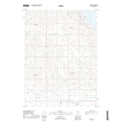
2017 Map of Taylor SE
USGS Topo · Published 2017About this map
The North Loup River winds through the southern reaches of this Loup County landscape, where the water-management infrastructure of the Nebraska Sandhills is clearly visible. This 2017 study illustrates the complex relationship between natural watercourses and agricultural irrigation, notably through the Taylor-Ord Canal and the upper reaches of the Calamus Reservoir in the northeast. The terrain is defined by a series of significant depressions and drainages, including Leydell Canyon, McCord Canyon, Bohys Canyon, and Bromwick Canyon, which cut through the undulating hills. A grid of rural routes such as Kent Rd and Calamus Dam Rd provides access to the remote sections of Townships 21 and 22 North, while the smaller Cedar Cr feeds into the primary river system, supporting the region's ranching and farming operations.
Find a feature on this map
25 named features on this map. Tap any name to fly to it.
Don’t see what you’re looking for? This feature index may not catch every label — zoom into the map to look around manually.
Map Details
Editions of this 2017 Taylor SE Map
This is the sole edition of this map. No revisions or reprints were ever made.
Other maps of this area

1952 · Burwell
USGS Topo · 1:24,000

1952 · Sargent East
USGS Topo · 1:24,000

1952 · Taylor NW
USGS Topo · 1:24,000

1952 · Sargent West
USGS Topo · 1:24,000

1952 · Taylor SE
USGS Topo · 1:24,000

1952 · Comstock NW
USGS Topo · 1:24,000

1952 · Taylor
USGS Topo · 1:24,000

1952 · Burwell NW
USGS Topo · 1:24,000

1952 · Taylor NE
USGS Topo · 1:24,000

1955 · Broken Bow
USGS Topo · 1:250,000