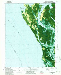
1982 Map of Taylors Island
USGS Topo · Published 1982About this map
Taylor Island and its surrounding Eastern Shore archipelago are presented here through a 1980s lens, blending topographic data with aerial imagery to reveal the intricate relationship between land and water. The settlement of Taylors Island serves as a central hub, connected to the mainland via Slaughter Creek. The landscape is dotted with ecclesiastical landmarks that speak to the area's long-standing community roots, including Bethlehem Ch, Old Trinity Ch, and Chaplain Mem Ch, many with associated burial grounds like Old Trinity Cem.
Find a feature on this map
52 named features on this map. Tap any name to fly to it.
Don’t see what you’re looking for? This feature index may not catch every label — zoom into the map to look around manually.
Map Details
Editions of this 1982 Taylors Island Map
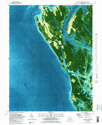
2 editions found
Other maps of this area

1892 · Drum Point
USGS Topo · 1:62,500

1893 · Sharps Island
USGS Topo · 1:62,500

1898 · Choptank
USGS Topo · 1:125,000

1898 · St. Marys
USGS Topo · 1:125,000

1901 · Drum Point
USGS Topo · 1:62,500

1904 · Sharps Island
USGS Topo · 1:62,500

1904 · Oxford
USGS Topo · 1:62,500

1905 · Crapo
USGS Topo · 1:62,500

1905 · Drum Point
USGS Topo · 1:62,500

1906 · St. Marys
USGS Topo · 1:125,000