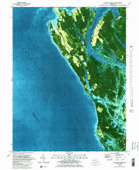
1982 Map of Taylors Island
USGS Topo · Published 1982About this map
Bethlehem Cem Ch and Old Trinity Cem Ch stand as historic markers on Taylors Island, an area where the land is intricately bound to the tides of the Chesapeake Bay. This 1982 orthophotomap documents a shoreline defined by complex waterways like Slaughter Creek and Parsons Creek, which separate the various necks of land including Piney Neck and Parsons Creek Neck. The map illustrates a rural landscape where small settlements like Smithville and the Taylors Island village are connected by narrow routes such as Robinson Road. Much of the southern territory is preserved within the Taylors Island Wildlife Management Area, characterized by expansive marshlands, tidal flats, and remote landmasses like Dunnock Island. This survey provides a precise look at the Dorchester County coast before modern development further altered the traditional Waterman culture's environment.
Find a feature on this map
47 named features on this map. Tap any name to fly to it.
Don’t see what you’re looking for? This feature index may not catch every label — zoom into the map to look around manually.
Map Details
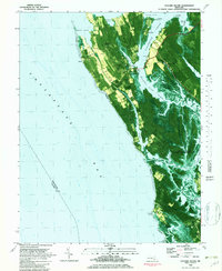
Editions of this 1982 Taylors Island Map
2 editions found
Other maps of this area

1892 · Drum Point
USGS Topo · 1:62,500

1893 · Sharps Island
USGS Topo · 1:62,500

1898 · Choptank
USGS Topo · 1:125,000

1898 · St. Marys
USGS Topo · 1:125,000

1901 · Drum Point
USGS Topo · 1:62,500

1904 · Sharps Island
USGS Topo · 1:62,500

1904 · Oxford
USGS Topo · 1:62,500

1905 · Crapo
USGS Topo · 1:62,500

1905 · Drum Point
USGS Topo · 1:62,500

1906 · St. Marys
USGS Topo · 1:125,000