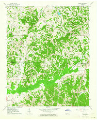
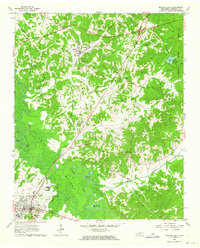
1961 Map of Teague
USGS Topo · Published 1964About this map
Uptonville and Teague anchor this 1961 field-checked landscape on the border of Madison and Hardeman Counties. The area is defined by a dense network of family-named roads and rural institutions, including Maple Springs Ch and Ebenezer Ch, which served the farming communities clustered near Muddy Creek and Cypress Creek. An intriguing historical marker is the Indian Mound located in the northern hills, suggesting much older layers of habitation alongside the mid-century farmsteads.
Find a feature on this map
37 named features on this map. Tap any name to fly to it.
Don’t see what you’re looking for? This feature index may not catch every label — zoom into the map to look around manually.
Map Details
Editions of this 1961 Teague Map
2 editions found
Other maps of this area

1950 · Jackson South
USGS Topo · 1:24,000

1956 · Blytheville
USGS Topo · 1:250,000

1959 · Blytheville
USGS Topo · 1:250,000

1959 · Westover
USGS Topo · 1:24,000

1959 · Denmark
USGS Topo · 1:24,000

1961 · Bolivar West
USGS Topo · 1:24,000

1961 · Medon
USGS Topo · 1:24,000
1961 · Silerton
USGS Topo · 1:24,000
1961 · Mercer
USGS Topo · 1:24,000
1961 · Bolivar East
USGS Topo · 1:24,000