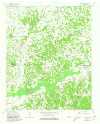
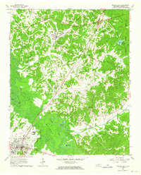
1961 Map of Teague
USGS Topo · Published 1981About this map
Bethlehem Ch and Maple Springs Ch stand near the headwaters of Pennycost Creek, marking a landscape of established rural congregations in West Tennessee. This survey captures the transition between Madison and Hardeman counties, where the terrain is defined by the broad wetlands of Clover Creek and the Central Illinois Gulf rail line. A notable site of historical interest is the Indian Mound located north of Hart Creek, suggesting a deep chronological history of habitation long before the arrival of Steam Mill or the scattered family farmsteads. Local genealogy is well-supported by the presence of Yarbrough Cem, Tate Cem, and Clover Creek Cem, alongside small settlements like Uptonville and Teague. The map also records specialized land use, such as the Fish Hatcheries situated near the junction of Dry Creek and Clover Creek.
Find a feature on this map
47 named features on this map. Tap any name to fly to it.
Don’t see what you’re looking for? This feature index may not catch every label — zoom into the map to look around manually.
Map Details
Editions of this 1961 Teague Map
2 editions found
Other maps of this area

1950 · Jackson South
USGS Topo · 1:24,000

1956 · Blytheville
USGS Topo · 1:250,000

1959 · Blytheville
USGS Topo · 1:250,000

1959 · Westover
USGS Topo · 1:24,000

1959 · Denmark
USGS Topo · 1:24,000

1961 · Bolivar West
USGS Topo · 1:24,000

1961 · Medon
USGS Topo · 1:24,000
1961 · Silerton
USGS Topo · 1:24,000
1961 · Mercer
USGS Topo · 1:24,000
1961 · Bolivar East
USGS Topo · 1:24,000