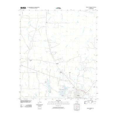
2010 Map of Teague North
USGS Topo · Published 2010About this map
Teague sits at the southern edge of this landscape, serving as a hub where the regional road network converges near the Lower Club Lake and Upper Club Lake reservoirs. The surrounding Freestone County countryside is defined by its agricultural and extractive history, clearly illustrated by the presence of the Bi-Stone Oil Field west of town. This energy production infrastructure exists alongside long-established rural settlements such as Simsboro and the appropriately named Cotton Gin, which speaks to the area's deep-rooted farming heritage.
Find a feature on this map
56 named features on this map. Tap any name to fly to it.
Don’t see what you’re looking for? This feature index may not catch every label — zoom into the map to look around manually.
Map Details
Editions of this 2010 Teague North Map
This is the sole edition of this map. No revisions or reprints were ever made.
Other maps of this area

1919 · Fairfield
USGS Topo · 1:62,500

1920 · Mexia
USGS Topo · 1:62,500

1954 · Waco
USGS Topo · 1:250,000

1955 · Waco
USGS Topo · 1:250,000

1963 · Wortham
USGS Topo · 1:24,000

1963 · Teague North
USGS Topo · 1:24,000

1963 · Kirvin
USGS Topo · 1:24,000
1963 · Stewards Mill
USGS Topo · 1:24,000

1963 · Mexia
USGS Topo · 1:24,000

1965 · Dew
USGS Topo · 1:24,000