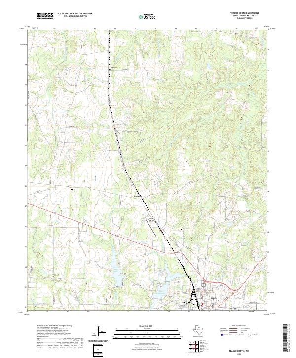
2022 Map of Teague North
USGS Topo · Published 2022About this map
Teague and Simsboro anchor this Freestone County landscape, where the terrain is defined by a dense network of meandering tributaries including White Rock Cr, Little Tehuacana Cr, and Caney Cr. The settlement pattern is largely rural, characterized by family-named landmarks and scattered burial grounds such as Carter Family Cem and Shanks Cem. Water management is central to the area's development, evidenced by the presence of Teague City Lake and the adjacent Upper Club Lake. The town of Teague serves as a local hub, with its grid of streets and municipal infrastructure like the Teague Municipal Airport providing a contrast to the winding country roads and ranch lands that dominate the surrounding countryside. Genealogists may find value in the specific locations of rural cemeteries like Cotton Gin Cem and Hopewell Cem, which mark long-established communities across this East Texas pocket.
Find a feature on this map
94 named features on this map. Tap any name to fly to it.
Don’t see what you’re looking for? This feature index may not catch every label — zoom into the map to look around manually.
Map Details
Editions of this 2022 Teague North Map
This is the sole edition of this map. No revisions or reprints were ever made.
Other maps of this area

1919 · Fairfield
USGS Topo · 1:62,500

1920 · Mexia
USGS Topo · 1:62,500

1954 · Waco
USGS Topo · 1:250,000

1955 · Waco
USGS Topo · 1:250,000

1963 · Wortham
USGS Topo · 1:24,000

1963 · Teague North
USGS Topo · 1:24,000

1963 · Kirvin
USGS Topo · 1:24,000
1963 · Stewards Mill
USGS Topo · 1:24,000

1963 · Mexia
USGS Topo · 1:24,000

1965 · Dew
USGS Topo · 1:24,000