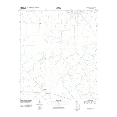
2010 Map of Teague South
USGS Topo · Published 2010About this map
Teague sits at the northern edge of this Freestone County landscape, where the local street grid gives way to a network of rural county roads and winding creek bottoms. The terrain is defined by the drainage systems of Chambers Creek and Cedar Creek, which create a complex pattern of small tributaries and branches across the central and southern portions of the quadrangle. Significant water management is evident at Browns Lake, held by Browns Dam, providing a focal point for the surrounding rural acreage.
Find a feature on this map
62 named features on this map. Tap any name to fly to it.
Don’t see what you’re looking for? This feature index may not catch every label — zoom into the map to look around manually.
Map Details
Editions of this 2010 Teague South Map
This is the sole edition of this map. No revisions or reprints were ever made.
Other maps of this area

1919 · Fairfield
USGS Topo · 1:62,500

1920 · Mexia
USGS Topo · 1:62,500

1954 · Waco
USGS Topo · 1:250,000

1955 · Waco
USGS Topo · 1:250,000

1956 · Jewett
USGS Topo · 1:62,500

1963 · Teague North
USGS Topo · 1:24,000

1963 · Mexia
USGS Topo · 1:24,000

1965 · Dew
USGS Topo · 1:24,000
1965 · Fairfield
USGS Topo · 1:24,000
1965 · Donie
USGS Topo · 1:24,000