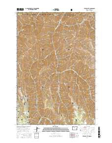
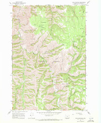
2017 Map of Teepee Butte
USGS Topo · Published 2017About this map
Wallowa National Forest dominates this high-elevation landscape where the borders of Asotin County, Washington, and Wallowa County, Oregon, meet. The terrain is defined by a series of steep drainages and prominent ridges that separate the waters of Joseph Canyon and Joseph Creek from the surrounding highlands. Notable landmarks such as Teepee Butte and Teepee Ridge stand as focal points in a region characterized by deep cuts like Lent Canyon and Elkhorn Gulch. This 2017 survey illustrates the complex network of Forest Service roads, including Nat For Dev Rd 596 and Teepee Rd, which provide access to remote areas like Hunting Camp Ridge and Wildhorse Ridge. The presence of Wildhorse Spring and Huffman Camp Spring indicates the critical water sources that support seasonal use in this high-country environment.
Find a feature on this map
35 named features on this map. Tap any name to fly to it.
Don’t see what you’re looking for? This feature index may not catch every label — zoom into the map to look around manually.
Map Details
Editions of this 2017 Teepee Butte Map
This is the sole edition of this map. No revisions or reprints were ever made.
Other maps of this area
1944 · Anatone
USGS Topo · 1:62,500
1946 · Limekiln Rapids
USGS Topo · 1:62,500
1946 · Anatone
USGS Topo · 1:62,500
1955 · Pullman
USGS Topo · 1:250,000

1955 · Grangeville
USGS Topo · 1:250,000
1958 · Pullman
USGS Topo · 1:250,000

1959 · Grangeville
USGS Topo · 1:250,000
1963 · Jim Creek Butte
USGS Topo · 1:24,000
1963 · Poison Point
USGS Topo · 1:24,000
1967 · Table Mountain
USGS Topo · 1:24,000