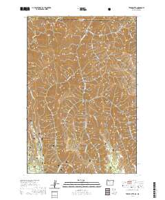
2020 Map of Teepee Butte
USGS Topo · Published 2020About this map
Joseph Canyon and its deep tributaries dominate this northern section of the Wallowa National Forest, where the state line divides the high-country drainage between Washington and Oregon. The landscape is defined by long, narrow promontories such as Hunting Camp Ridge and Teepee Ridge, which separate the various branches of Joseph Cr and Cottonwood Cr. The map captures a rugged interior used primarily for forestry and seasonal camps, evidenced by features like Huffman Camp Spring and the remote Wildhorse Spring tucked into the headwaters. In the southeast, Teepee Butte rises as a distinct landmark overlooking Bear Flat, while Horse Creek Rd provides one of the few vehicular access points through the steep canyon network. This modern survey details the intricate hydrology of the Basin Creek and Broady Cr systems, illustrating how the terrain dictates the isolation of the high plateaus.
Find a feature on this map
34 named features on this map. Tap any name to fly to it.
Don’t see what you’re looking for? This feature index may not catch every label — zoom into the map to look around manually.
Map Details
Editions of this 2020 Teepee Butte Map
This is the sole edition of this map. No revisions or reprints were ever made.
Other maps of this area

1944 · Anatone
USGS Topo · 1:62,500

1946 · Limekiln Rapids
USGS Topo · 1:62,500

1946 · Anatone
USGS Topo · 1:62,500

1955 · Pullman
USGS Topo · 1:250,000

1955 · Grangeville
USGS Topo · 1:250,000

1958 · Pullman
USGS Topo · 1:250,000

1959 · Grangeville
USGS Topo · 1:250,000

1963 · Jim Creek Butte
USGS Topo · 1:24,000

1963 · Poison Point
USGS Topo · 1:24,000
1967 · Table Mountain
USGS Topo · 1:24,000