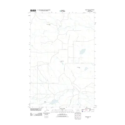
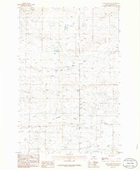
2011 Map of Teigen NW
USGS Topo · Published 2011About this map
Three Buttes rises as a prominent landmark in this section of Fergus County, overlooking a high-plains landscape defined by seasonal drainages and early 21st-century water management. The area is characterized by a network of ranch roads and small-scale water infrastructure, including the Delaney Number 2 Dam, Harris Number 1 Dam, and Ducky Number 1 Dam. These reservoirs are critical components of the local pastoral economy, situated along natural watercourses such as South Fork Bear Creek and Fords Creek. The map documents a sparse but deliberate transportation grid, with routes like Welter Divide Rd and Blakeslee Rd connecting isolated homesteads and grazing lands. The presence of Brickyard Creek and Briggs Coulee Rd reflects the naming conventions of early settlers and the topographical nuances of the Montana coulee country.
Find a feature on this map
13 named features on this map. Tap any name to fly to it.
Don’t see what you’re looking for? This feature index may not catch every label — zoom into the map to look around manually.
Map Details
Editions of this 2011 Teigen NW Map
This is the sole edition of this map. No revisions or reprints were ever made.
Other maps of this area

1954 · Lewistown
USGS Topo · 1:250,000

1959 · Lewistown
USGS Topo · 1:250,000

1985 · Bear Creek Reservoir SE
USGS Topo · 1:24,000
1985 · Bear Creek Reservoir
USGS Topo · 1:24,000
1985 · Bohemian Corners
USGS Topo · 1:24,000

1986 · Wild Horse Lake
USGS Topo · 1:24,000

1986 · Briggs Coulee
USGS Topo · 1:24,000
1986 · Grass Range
USGS Topo · 1:24,000

1986 · Teigen NW
USGS Topo · 1:24,000
1986 · Grass Range NE
USGS Topo · 1:24,000