
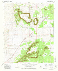
1978 Map of Tejon
USGS Topo · Published 1978About this map
Tejon and Carnero sit within a high-desert landscape defined by the intersection of major southwestern transport corridors during the late 1970s. The northern portion of the map is dominated by the Atchison Topeka and Santa Fe railroad line, while the Southern Pacific cuts diagonally through the southern sections, marking a critical junction of rail infrastructure in eastern New Mexico.
Find a feature on this map
9 named features on this map. Tap any name to fly to it.
Don’t see what you’re looking for? This feature index may not catch every label — zoom into the map to look around manually.
Map Details
Editions of this 1978 Tejon Map
This is the sole edition of this map. No revisions or reprints were ever made.
Other maps of this area

1954 · Fort Sumner
USGS Topo · 1:250,000

1958 · Fort Sumner
USGS Topo · 1:250,000

1978 · Mesa Leon
USGS Topo · 1:24,000

1978 · Santa Barbara Lake
USGS Topo · 1:24,000

1978 · Vaughn
USGS Topo · 1:24,000

1978 · Encino
USGS Topo · 1:24,000

1978 · Dunlap Ranch
USGS Topo · 1:24,000

1980 · Corona
USGS Topo · 1:100,000

1981 · Gacho Hill NW
USGS Topo · 1:24,000
1981 · Duran
USGS Topo · 1:24,000