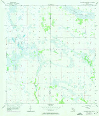
1956 Map of Telegraph Swamp NE
USGS Topo · Published 1974About this map
The boundary between Charlotte Co and Glades Co bisects this mid-century landscape of South Florida's interior. This survey illustrates a vast, interconnected wetland system dominated by the wide drainage of Rainey Slough in the northern portion and the winding course of Jacks Branch to the south. The absence of named towns or infrastructure highlights the area's character as a seasonal wilderness and cattle range in the mid-1950s, before modern water management and development significantly altered the region's hydrology. Grounded in data from 1951 aerial photography and 1956 planetable surveys, the map provides an essential baseline for understanding the historic flow of the Everglades' western headwaters.
Find a feature on this map
3 named features on this map. Tap any name to fly to it.
Don’t see what you’re looking for? This feature index may not catch every label — zoom into the map to look around manually.
Map Details
Editions of this 1956 Telegraph Swamp NE Map
2 editions found
Other maps of this area

1956 · Telegraph Swamp
USGS Topo · 1:24,000

1956 · Telegraph Swamp NE
USGS Topo · 1:24,000

1956 · Telegraph Swamp NW
USGS Topo · 1:24,000

1956 · Long Island Marsh SW
USGS Topo · 1:24,000

1956 · West Palm Beach
USGS Topo · 1:250,000

1956 · Fort Pierce
USGS Topo · 1:250,000

1957 · West Palm Beach
USGS Topo · 1:250,000

1957 · Long Island Marsh SE
USGS Topo · 1:24,000

1957 · Venus SW
USGS Topo · 1:24,000

1957 · Telegraph Swamp SE
USGS Topo · 1:24,000