
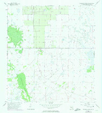
1956 Map of Telegraph Swamp NW
USGS Topo · Published 1957About this map
Telegraph Swamp dominates this landscape in southern Florida, its wetlands and marshes mapped in high detail via 1956 planetable surveys. The terrain is characterized by an intricate network of intermittent water bodies and cypress strands typical of the region's interior before significant modern drainage projects. An Old Railroad Grade cuts across the southern portion of the quadrangle, serving as a primary cultural landmark and indicating an era of earlier industrial activity or resource extraction that has since transitioned. This 1950s survey provides a precise record of the natural hydrology and early infrastructure in Charlotte County, where surveying was still heavily reliant on physical planetable work to capture the subtle elevation changes of the Florida flatwoods.
Find a feature on this map
2 named features on this map. Tap any name to fly to it.
Don’t see what you’re looking for? This feature index may not catch every label — zoom into the map to look around manually.
Map Details
Editions of this 1956 Telegraph Swamp NW Map
2 editions found
Other maps of this area

1956 · Arcadia SE
USGS Topo · 1:24,000

1956 · Telegraph Swamp
USGS Topo · 1:24,000

1956 · Telegraph Swamp NE
USGS Topo · 1:24,000

1956 · Long Island Marsh SW
USGS Topo · 1:24,000

1956 · Bermont
USGS Topo · 1:24,000

1956 · West Palm Beach
USGS Topo · 1:250,000

1956 · Fort Pierce
USGS Topo · 1:250,000

1957 · West Palm Beach
USGS Topo · 1:250,000

1957 · Long Island Marsh SE
USGS Topo · 1:24,000

1957 · Tuckers Corner
USGS Topo · 1:24,000