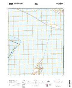
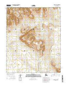
2017 Map of Teller B-4 SW
USGS Topo · Published 2017About this map
Point Spencer defines the coastal character of this remote landscape, a narrow spit of land reaching into the waters where Norton Sound meets Port Clarence. This 2017 survey details a critical maritime and security outpost on the Seward Peninsula, anchored by the Port Clarence Coast Guard Station at the tip of the peninsula. The map illustrates a delicate balance of land and water, where the salt-streaked waters of Breving Lagoon and the winding course of Thompson Cr shape the northern boundary. Settlement is sparse, concentrated at the site of Port Clarence, which serves as a solitary focal point for navigation and logistics in the Nome Census Area. This chart records the state of these vital arctic facilities and the shifting coastal hydrology just before the close of the decade.
Find a feature on this map
15 named features on this map. Tap any name to fly to it.
Don’t see what you’re looking for? This feature index may not catch every label — zoom into the map to look around manually.
Map Details
Editions of this 2017 Teller B-4 SW Map
This is the sole edition of this map. No revisions or reprints were ever made.
Other maps of this area

1950 · Teller
USGS Topo · 1:250,000

1950 · Teller B-4
USGS Topo · 1:63,360

1950 · Teller A-4
USGS Topo · 1:63,360
1950 · Teller B-5
USGS Topo · 1:63,360

1951 · Teller
USGS Topo · 1:250,000

1957 · Teller
USGS Topo · 1:250,000

1958 · Teller
USGS Topo · 1:250,000
2014 · Teller B-5 NE
USGS Topo · 1:25,000
2014 · Teller B-4 NW
USGS Topo · 1:25,000
2014 · Teller B-4 NE
USGS Topo · 1:25,000