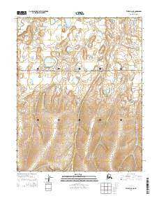
2014 Map of Teller D-2 NE
USGS Topo · Published 2014About this map
Bering Land Bridge National Preserve encompasses a significant portion of this terrain in the Nome region, protecting a landscape where ancient migrations once crossed between continents. The northern reaches of the map are defined by the winding course of the Arctic River, while the Sanaguich River and its various tributaries, including Bonanza Cr, carve through the topography further south. This 2014 survey documents the hydrographic patterns of the area, showing the Eldorado Cr as it flows toward the southern boundary. The map is a detailed record of water drainage and preservation boundaries in a region where the natural environment remains the primary feature, largely untouched by permanent settlements or industrial infrastructure.
Find a feature on this map
11 named features on this map. Tap any name to fly to it.
Don’t see what you’re looking for? This feature index may not catch every label — zoom into the map to look around manually.
Map Details
Editions of this 2014 Teller D-2 NE Map
This is the sole edition of this map. No revisions or reprints were ever made.
Other maps of this area

1950 · Teller
USGS Topo · 1:250,000

1950 · Shishmaref
USGS Topo · 1:250,000

1950 · Shishmaref A-1
USGS Topo · 1:63,360

1950 · Teller D-2
USGS Topo · 1:63,360

1950 · Shishmaref A-2
USGS Topo · 1:63,360

1950 · Teller D-1
USGS Topo · 1:63,360

1951 · Shishmaref
USGS Topo · 1:250,000

1951 · Teller
USGS Topo · 1:250,000

1957 · Teller
USGS Topo · 1:250,000

1958 · Teller
USGS Topo · 1:250,000