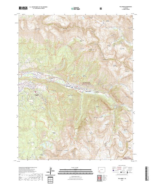
2022 Map of Telluride
USGS Topo · Published 2022About this map
Telluride serves as the focal point of this high-altitude landscape, situated along the San Miguel River beneath the towering peaks of the Uncompahgre National Forest. The map documents a town defined by its transitions, where the historic footprint of the San Miguel County Courthouse and Lone Tree Cem meets the modern development of Mountain Village. The surrounding terrain is a complex web of industrial history and recreation, evidenced by an extensive network of trails like the Lewis Mine Trl and Legacy Trl that navigate the steep slopes toward Pandora. High alpine basins such as Yankee Boy Basin and Marshall Basin are etched into the San Juan Mountains, while water features like Silver Lake and the dramatic Cornet Falls highlight the region's steep hydrology. The southern portion of the map transitions into the San Juan National Forest, featuring the Alta Lakes area and the notable San Joaquin Ridge.
Find a feature on this map
140 named features on this map. Tap any name to fly to it.
Don’t see what you’re looking for? This feature index may not catch every label — zoom into the map to look around manually.
Map Details
Editions of this 2022 Telluride Map
This is the sole edition of this map. No revisions or reprints were ever made.
Other maps of this area

1897 · Telluride
USGS Topo · 1:62,500

1897 · Silverton
USGS Topo · 1:62,500

1901 · Silverton
USGS Topo · 1:62,500

1902 · Silverton
USGS Topo · 1:62,500

1902 · Ouray
USGS Topo · 1:62,500

1904 · Ouray
USGS Topo · 1:62,500

1904 · Telluride
USGS Topo · 1:62,500

1909 · Montrose
USGS Topo · 1:125,000

1911 · Montrose
USGS Topo · 1:125,000

1945 · Durango
USGS Topo · 1:250,000