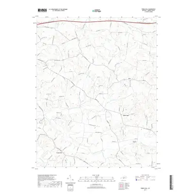
2019 Map of Temple Hill
USGS Topo · Published 2019About this map
The crossroads of Temple Hill and Eighty Eight anchor this detailed study of Barren County, where a complex network of creeks and ridges defines the rural landscape. The terrain is deeply incised by Falling Timber Creek and its many tributaries, such as Bailey Br and Brushy Fork, creating a geographic pattern that has historically dictated road placement and property lines. In the northern reaches, the settlement of Kino and the waters of Swannigan Cr mark the transition toward the Beaver Creek drainage system.
Find a feature on this map
105 named features on this map. Tap any name to fly to it.
Don’t see what you’re looking for? This feature index may not catch every label — zoom into the map to look around manually.
Map Details
Editions of this 2019 Temple Hill Map
This is the sole edition of this map. No revisions or reprints were ever made.
Other maps of this area

1935 · Horse Cave
USGS Topo · 1:48,000

1938 · Horse Cave
USGS Topo · 1:62,500

1953 · Sulphur Well
USGS Topo · 1:24,000

1953 · Tracy
USGS Topo · 1:24,000

1953 · Sulphur Lick
USGS Topo · 1:24,000

1953 · Temple Hill
USGS Topo · 1:24,000

1953 · Glasgow South
USGS Topo · 1:24,000

1953 · Freedom
USGS Topo · 1:24,000

1953 · Summer Shade
USGS Topo · 1:24,000
1954 · Glasgow North
USGS Topo · 1:24,000