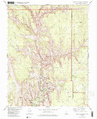
1980 Map of Temple of Sinawava
USGS Topo · Published 1985About this map
Zion Lodge sits at the heart of this 1980 survey, serving as the central human anchor amidst the vertical architecture of Zion National Park. The North Fork Virgin River carves its way through the canyon, shaping iconic features like the Temple of Sinawava, The Organ, and the Big Bend. A detailed network of pack trails, including the West Rim (Pack) Trail and East Rim (Pack) Trail, provides a record of the backcountry access routes used before modern infrastructure expansions. These paths connect significant landmarks such as Angels Landing, The Great White Throne, and Observation Point. Water sources critical for early development and tourism are meticulously noted, from The Grotto and Emerald Pools to higher elevation sites like Stave Spring and Lemmon Spring. This edition documents the canyon's geological and navigational layout just as it became a cornerstone of the American West's outdoor identity.
Find a feature on this map
62 named features on this map. Tap any name to fly to it.
Don’t see what you’re looking for? This feature index may not catch every label — zoom into the map to look around manually.
Map Details
Editions of this 1980 Temple of Sinawava Map
3 editions found
Other maps of this area

1885 · St. George
USGS Topo · 1:250,000

1886 · Kanab
USGS Topo · 1:250,000

1891 · St. George
USGS Topo · 1:250,000

1953 · Cedar City
USGS Topo · 1:250,000

1954 · Orderville Canyon NW
USGS Topo · 1:24,000

1954 · Orderville Canyon SE
USGS Topo · 1:24,000

1956 · Springdale NE
USGS Topo · 1:24,000

1957 · Orderville Canyon NE
USGS Topo · 1:24,000

1958 · Cedar City
USGS Topo · 1:250,000

1962 · Cedar City
USGS Topo · 1:250,000