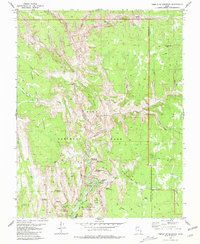
1980 Map of Temple of Sinawava
USGS Topo · Published 1980About this map
Zion National Park is documented here during the late 1970s, showcasing the intricate relationship between the North Fork Virgin River and the towering formations of the main canyon. The map details the central visitor corridor, including the Zion Lodge and several key trailheads such as The Grotto. Iconic monoliths and viewpoints are precisely located, from the soaring height of Angels Landing and The Great White Throne to the sheer face of Cable Mountain.
Find a feature on this map
59 named features on this map. Tap any name to fly to it.
Don’t see what you’re looking for? This feature index may not catch every label — zoom into the map to look around manually.
Map Details
Editions of this 1980 Temple of Sinawava Map
3 editions found
Other maps of this area

1885 · St. George
USGS Topo · 1:250,000

1886 · Kanab
USGS Topo · 1:250,000

1891 · St. George
USGS Topo · 1:250,000

1953 · Cedar City
USGS Topo · 1:250,000

1954 · Orderville Canyon NW
USGS Topo · 1:24,000

1954 · Orderville Canyon SE
USGS Topo · 1:24,000

1956 · Springdale NE
USGS Topo · 1:24,000

1957 · Orderville Canyon NE
USGS Topo · 1:24,000

1958 · Cedar City
USGS Topo · 1:250,000

1962 · Cedar City
USGS Topo · 1:250,000