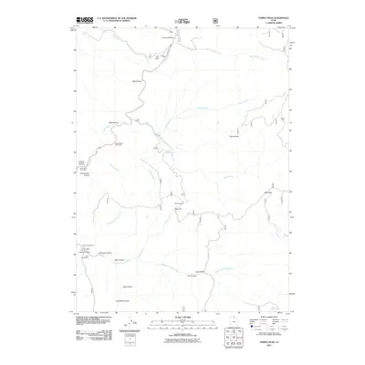
2011 Map of Temple Peak
USGS Topo · Published 2011About this map
Temple Peak dominates the central landscape of this Cache County survey, serving as a focal point for a complex drainage system that includes Temple Fork, Spawn Creek, and the Logan River. The area is defined by its recreational and agricultural utility, from the seasonal Brachipad Summer Home Area to the cattle-handling sites at Twin Creek Corral and Hunsaker Corral.
Find a feature on this map
30 named features on this map. Tap any name to fly to it.
Don’t see what you’re looking for? This feature index may not catch every label — zoom into the map to look around manually.
Map Details
Editions of this 2011 Temple Peak Map
This is the sole edition of this map. No revisions or reprints were ever made.
Other maps of this area

1912 · Randolph
USGS Topo · 1:125,000

1914 · Logan
USGS Topo · 1:125,000

1916 · Logan
USGS Topo · 1:125,000

1949 · Boulter Mts
USGS Topo · 1:24,000

1954 · Ogden
USGS Topo · 1:250,000

1958 · Ogden
USGS Topo · 1:250,000

1960 · Ogden
USGS Topo · 1:250,000
1969 · Tony Grove Creek
USGS Topo · 1:24,000

1969 · Boulder Mtn
USGS Topo · 1:24,000
1969 · Logan Peak
USGS Topo · 1:24,000