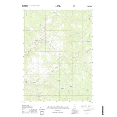
2020 Map of Temple Peak
USGS Topo · Published 2020About this map
Ephraims Grave lies in the southern reaches of this mountain landscape, a specific landmark set against the backdrop of Cache National Forest. The map documents a complex drainage system where the Right Fork Logan River and Temple Fork carve through the high terrain, creating named features like Logan Canyon and Cowley Canyon. Evidence of early industry and resource management is found at the Temple Fork Sawmill and via several wildlife water catchments like the Spawn Cr Guzzler.
Find a feature on this map
68 named features on this map. Tap any name to fly to it.
Don’t see what you’re looking for? This feature index may not catch every label — zoom into the map to look around manually.
Map Details
Editions of this 2020 Temple Peak Map
This is the sole edition of this map. No revisions or reprints were ever made.
Other maps of this area

1912 · Randolph
USGS Topo · 1:125,000

1914 · Logan
USGS Topo · 1:125,000

1916 · Logan
USGS Topo · 1:125,000

1949 · Boulter Mts
USGS Topo · 1:24,000

1954 · Ogden
USGS Topo · 1:250,000

1958 · Ogden
USGS Topo · 1:250,000

1960 · Ogden
USGS Topo · 1:250,000
1969 · Tony Grove Creek
USGS Topo · 1:24,000

1969 · Boulder Mtn
USGS Topo · 1:24,000
1969 · Logan Peak
USGS Topo · 1:24,000