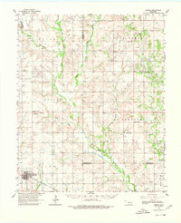
1962 Map of Temple
USGS Topo · Published 1980About this map
Temple stands as the primary hub in this southwestern Oklahoma landscape, defined by a complex network of oil and gas exploration. Large tracts like the Walters Oil Field and Empire Oil Field dominate the terrain, interspersed with small petroleum settlements such as Gas City and Empire City. The Chicago Rock Island and Pacific railroad bisects the southern portion of the territory, providing a vital transportation artery through the Bour Land and Price districts.
Find a feature on this map
43 named features on this map. Tap any name to fly to it.
Don’t see what you’re looking for? This feature index may not catch every label — zoom into the map to look around manually.
Map Details
Editions of this 1962 Temple Map
2 editions found

Other maps of this area

1901 · Addington
USGS Topo · 1:125,000

1902 · Rush Springs
USGS Topo · 1:125,000

1946 · Lawton
USGS Topo · 1:62,500

1949 · Nellie
USGS Topo · 1:62,500

1950 · Marlow
USGS Topo · 1:62,500

1951 · Marlow
USGS Topo · 1:62,500

1955 · Lawton
USGS Topo · 1:250,000

1956 · Ninemile Creek
USGS Topo · 1:24,000

1956 · Letitia
USGS Topo · 1:24,000

1956 · Nellie
USGS Topo · 1:24,000