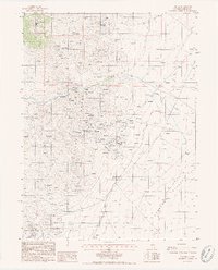
1985 Map of Tenabo
USGS Topo · Published 1986About this map
The Shoshone Range dominates this mid-1980s survey, revealing a landscape defined by intensive mining operations and the stark transition to the floor of Crescent Valley. The small settlement of Tenabo sits at the head of Gold Quartz Gulch, surrounded by a dense network of shafts and prospect pits that trace the mineral veins through Altenburg Hill. To the south, the massive footprint of the Gold Acres Mine includes extensive Tailings Ponds, Tailings Dump areas, and a significant Mine Tunnel, showing the industrial scale of gold extraction during this era.
Find a feature on this map
35 named features on this map. Tap any name to fly to it.
Don’t see what you’re looking for? This feature index may not catch every label — zoom into the map to look around manually.
Map Details
Editions of this 1985 Tenabo Map
2 editions found
Other maps of this area

1938 · Cortez
USGS Topo · 1:48,000

1944 · Cortez
USGS Topo · 1:62,500

1949 · Crescent Valley
USGS Topo · 1:62,500

1949 · Mt. Lewis
USGS Topo · 1:62,500

1950 · Mt. Lewis
USGS Topo · 1:62,500

1950 · Crescent Valley
USGS Topo · 1:62,500

1955 · Winnemucca
USGS Topo · 1:250,000

1958 · Winnemucca
USGS Topo · 1:250,000

1962 · Winnemucca
USGS Topo · 1:250,000

1962 · Carico Lake
USGS Topo · 1:62,500