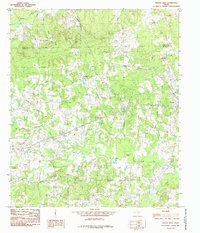
1984 Map of Tenaha West
USGS Topo · Published 1985About this map
Tennessee and the surrounding piney woods of East Texas are documented here in the early 1980s, revealing a landscape defined by its creek networks and small rural clusters. The map details the area north of the Panola Co Shelby Co line, where the terrain is dominated by the many branches of Flat Fork Creek and Ramsey Creek. Local history is anchored by the Tennessee Cem and the nearby Rodeo Ground, highlighting the cultural and communal centers of this rural district.
Find a feature on this map
20 named features on this map. Tap any name to fly to it.
Don’t see what you’re looking for? This feature index may not catch every label — zoom into the map to look around manually.
Map Details
Editions of this 1984 Tenaha West Map
This is the sole edition of this map. No revisions or reprints were ever made.
Other maps of this area

1945 · Socagee Bayou
USGS Topo · 1:62,500

1953 · Palestine
USGS Topo · 1:250,000

1956 · Tyler
USGS Topo · 1:250,000

1956 · Deadwood
USGS Topo · 1:62,500

1957 · Palestine
USGS Topo · 1:250,000

1958 · Center
USGS Topo · 1:62,500

1958 · Timpson
USGS Topo · 1:62,500

1958 · Carthage
USGS Topo · 1:62,500
1983 · Old Center
USGS Topo · 1:24,000
1983 · Gary
USGS Topo · 1:24,000