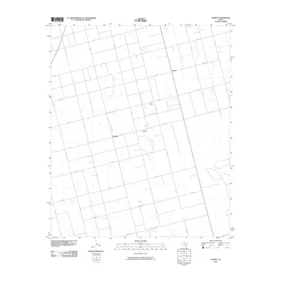
2010 Map of Tenmile
USGS Topo · Published 2010About this map
The settlement of Klondike and the nearby community of Tenmile anchor this West Texas landscape in Dawson County. This map highlights a region defined by a rigid grid of county roads, such as Co RD 28 and Co RD 30, which slice through the flat agricultural terrain. The presence of the Tex Hamon Oil Field reflects the area's industrial reliance on petroleum extraction, while the Thorp Airport provides a localized aviation link for the surrounding farming and ranching operations. The southern portion of the quadrangle is accessed by Farm Rd 2002-E, connecting the rural interior to the broader state highway system. Topographic contours show a largely level surface typical of the Llano Estacado, punctuated by small, scattered depressions.
Find a feature on this map
16 named features on this map. Tap any name to fly to it.
Don’t see what you’re looking for? This feature index may not catch every label — zoom into the map to look around manually.
Map Details
Editions of this 2010 Tenmile Map
This is the sole edition of this map. No revisions or reprints were ever made.
Other maps of this area

1954 · Hobbs
USGS Topo · 1:250,000

1954 · Big Spring
USGS Topo · 1:250,000

1958 · Big Spring
USGS Topo · 1:250,000

1958 · Hobbs
USGS Topo · 1:250,000

1966 · Wolcott Ranch
USGS Topo · 1:24,000

1966 · Merrick
USGS Topo · 1:24,000

1966 · Flower Grove
USGS Topo · 1:24,000

1970 · Patricia
USGS Topo · 1:24,000

1970 · Lamesa South
USGS Topo · 1:24,000

1970 · Key
USGS Topo · 1:24,000