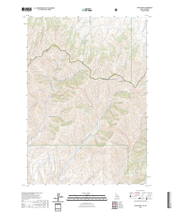
2023 Map of Tepee Draw
USGS Topo · Published 2023About this map
The Beaverhead Mountains define the high-altitude boundary between Idaho and Montana, where the Continental Divide winds through a landscape managed by two major federal agencies. This 2023 survey illustrates the shared border between Beaverhead National Forest and Targhee National Forest, a region defined by its complex drainage systems and high-elevation trails. Central to the map is the Continental Divide National Scenic Trl, which follows the ridgelines east toward the West Fork Big Beaver Creek. Below the peaks, a network of seasonal watercourses like Middle Creek, Poison Creek, and Dead Horse Creek carve through the terrain. Evidence of back-country access is visible through the Tepee Draw Trl and the Corral Canyon Trl, while the W Fork Indian Creek Rd provides a primary route into the southern forest lands.
Find a feature on this map
28 named features on this map. Tap any name to fly to it.
Don’t see what you’re looking for? This feature index may not catch every label — zoom into the map to look around manually.
Map Details
Editions of this 2023 Tepee Draw Map
This is the sole edition of this map. No revisions or reprints were ever made.
Other maps of this area

1955 · Dubois
USGS Topo · 1:250,000

1957 · Paul Reservoir
USGS Topo · 1:62,500

1957 · Edie Ranch
USGS Topo · 1:62,500

1958 · Dubois
USGS Topo · 1:250,000

1965 · Lima Peaks
USGS Topo · 1:24,000

1968 · Snowline
USGS Topo · 1:24,000

1968 · Monida
USGS Topo · 1:24,000

1983 · Dubois
USGS Topo · 1:100,000
1987 · Thunder Gulch
USGS Topo · 1:24,000
1987 · Indian Creek
USGS Topo · 1:24,000