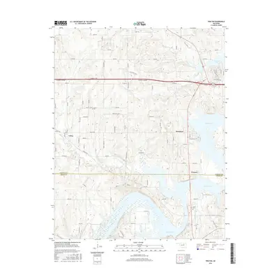
2016 Map of Terlton
USGS Topo · Published 2016About this map
Keystone Lake dominates the eastern half of this landscape, its fingers reaching into the surrounding terrain where the Pawnee Co and Creek Co lines intersect. The settlement of Terlton sits at the western edge, connected to the larger community of Mannford and the lakeside village of Westport by a network of rural roads and the major corridor of the Cimarron Turnpike. This modern survey illustrates the balance between mid-century infrastructure projects and the established rural homesteads that preceded them, indicated by landmarks such as Orcutts Corner and the Terlton Cem. Water remains a central theme of the geography, with Bear Creek, Cowskin Cr, and House Cr feeding into the reservoir. Local history and genealogy researchers can find significant family-related sites including Oakhill Cem and named thoroughfares like Jordan Valley Rd and D Lewis Rd.
Find a feature on this map
60 named features on this map. Tap any name to fly to it.
Don’t see what you’re looking for? This feature index may not catch every label — zoom into the map to look around manually.
Map Details
Editions of this 2016 Terlton Map
This is the sole edition of this map. No revisions or reprints were ever made.
Other maps of this area

1912 · Hominy
USGS Topo · 1:125,000

1915 · Hominy
USGS Topo · 1:125,000

1915 · Hominy
USGS Topo · 1:62,500

1929 · Yale
USGS Topo · 1:62,500

1929 · Skedee
USGS Topo · 1:62,500

1931 · Skedee
USGS Topo · 1:62,500

1932 · Yale
USGS Topo · 1:62,500

1955 · Enid
USGS Topo · 1:250,000

1958 · Enid
USGS Topo · 1:250,000

1958 · Keystone Dam
USGS Topo · 1:24,000