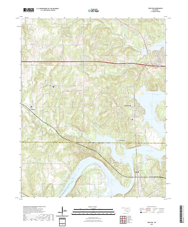
2022 Map of Terlton
USGS Topo · Published 2022About this map
Keystone Lake dominates the eastern and southern reaches of this landscape where the borders of Pawnee and Creek counties meet. The settlement of Terlton sits on the western edge of the quadrangle, connected to the larger community of Mannford and the lakeside village of Westport by a network of rural roads such as Terlton 48 Rd and Old State Hwy 51. The terrain is defined by the intricate finger-like inlets of the lake, which has submerged the lower valleys of House Creek and Cowskin Creek. Local history is anchored by sites like Terlton Cemetery near Orcutts Corner and Oakhill Cemetery to the southeast. The transition from agricultural upland roads like Jordan Valley Rd to the expansive water of the reservoir illustrates the region's managed hydrology and its impact on local transit and settlement patterns.
Find a feature on this map
53 named features on this map. Tap any name to fly to it.
Don’t see what you’re looking for? This feature index may not catch every label — zoom into the map to look around manually.
Map Details
Editions of this 2022 Terlton Map
This is the sole edition of this map. No revisions or reprints were ever made.
Other maps of this area

1912 · Hominy
USGS Topo · 1:125,000

1915 · Hominy
USGS Topo · 1:125,000

1915 · Hominy
USGS Topo · 1:62,500

1929 · Yale
USGS Topo · 1:62,500

1929 · Skedee
USGS Topo · 1:62,500

1931 · Skedee
USGS Topo · 1:62,500

1932 · Yale
USGS Topo · 1:62,500

1955 · Enid
USGS Topo · 1:250,000

1958 · Enid
USGS Topo · 1:250,000

1958 · Keystone Dam
USGS Topo · 1:24,000