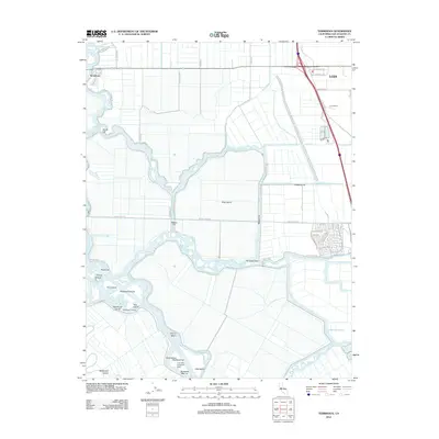
2012 Map of Terminous
USGS Topo · Published 2012About this map
King Island and the complex waterways of the Sacramento-San Joaquin River Delta define this map, illustrating the intricate relationship between reclaimed agricultural tracts and tidal channels. The settlement of Terminous sits at the confluence of the S Mokelumne River and Little Potato Slough, serving as a primary point of access to the water. The landscape is a network of named cuts and sloughs, including Honker Cut, White Slough, and Disappointment Slough, which separate large land tracts like the Empire Tract and Rindge Tract.
Find a feature on this map
62 named features on this map. Tap any name to fly to it.
Don’t see what you’re looking for? This feature index may not catch every label — zoom into the map to look around manually.
Map Details
Editions of this 2012 Terminous Map
This is the sole edition of this map. No revisions or reprints were ever made.
Other maps of this area

1894 · Lodi
USGS Topo · 1:125,000

1910 · New Hope
USGS Topo · 1:31,680

1910 · Castle
USGS Topo · 1:31,680

1910 · Bouldin
USGS Topo · 1:31,680

1910 · Woodbridge
USGS Topo · 1:31,680

1910 · Headreach
USGS Topo · 1:31,680

1910 · Isleton
USGS Topo · 1:31,680

1913 · Woodward Island
USGS Topo · 1:31,680

1913 · Stockton
USGS Topo · 1:31,680

1913 · Holt
USGS Topo · 1:31,680