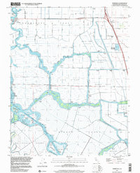
1997 Map of Terminous
USGS Topo · Published 2002About this map
The San Joaquin River and Mokelumne River converge in this intricate delta landscape, defining a network of man-made channels and reclaimed islands. In the late 1990s, the area around Terminous was characterized by significant tracts of agricultural land like the Empire Tract and Rindge Tract, protected by a series of levees and cuts. The presence of numerous pumping stations throughout the Shin Kee Tract and King Island emphasizes the constant water management required for this subsidence area. Social and recreational hubs are scattered throughout the waterways, from the Venice King Sch to the South Spud Island Recreation Area. Notable infrastructure includes the White Slough Water Pollution Control Plant and the emerging Thornton Road corridor, indicating the persistent balance between the delta's hydraulic engineering and regional development.
Find a feature on this map
61 named features on this map. Tap any name to fly to it.
Don’t see what you’re looking for? This feature index may not catch every label — zoom into the map to look around manually.
Map Details
Editions of this 1997 Terminous Map
This is the sole edition of this map. No revisions or reprints were ever made.
Other maps of this area

1894 · Lodi
USGS Topo · 1:125,000

1910 · New Hope
USGS Topo · 1:31,680

1910 · Castle
USGS Topo · 1:31,680

1910 · Bouldin
USGS Topo · 1:31,680

1910 · Woodbridge
USGS Topo · 1:31,680

1910 · Headreach
USGS Topo · 1:31,680

1910 · Isleton
USGS Topo · 1:31,680

1913 · Woodward Island
USGS Topo · 1:31,680

1913 · Stockton
USGS Topo · 1:31,680

1913 · Holt
USGS Topo · 1:31,680