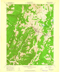
1959 Map of Terra Alta
USGS Topo · Published 1960About this map
Terra Alta sits at a critical junction of mountain geography and rail infrastructure, dominated by the heavy tracks of the Baltimore and Ohio Railroad slicing through the terrain. In the late 1950s, this area of Preston County served as a significant center for public health and local industry, marked by the expansive State Tuberculosis Sanitarium near Hopemont. The landscape is a complex of high ridges like the Briery Mountains and the Brushy Knobs, where small rural communities are anchored by numerous country churches such as Freeland Ch, Whitedale Ch, and Wesley Chapel. Along the waterways of Saltlick Creek and Snowy Creek, the map records a transition from traditional agriculture and small settlements like Rodemer and Freeport to more industrial activities, including a Quarry and a Lime Plant Sch.
Find a feature on this map
46 named features on this map. Tap any name to fly to it.
Don’t see what you’re looking for? This feature index may not catch every label — zoom into the map to look around manually.
Map Details
Editions of this 1959 Terra Alta Map
4 editions found
Other maps of this area

1886 · St. George
USGS Topo · 1:125,000

1891 · St. George
USGS Topo · 1:125,000

1895 · Piedmont
USGS Topo · 1:125,000

1899 · Oakland
USGS Topo · 1:62,500

1900 · Accident
USGS Topo · 1:62,500

1900 · Oakland
USGS Topo · 1:62,500

1904 · Bruceton
USGS Topo · 1:62,500

1907 · Kingwood
USGS Topo · 1:62,500

1925 · Kingwood
USGS Topo · 1:62,500

1926 · Bruceton
USGS Topo · 1:62,500