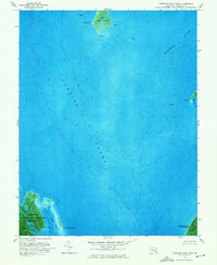
1973 Map of Terrapin Sand Point
USGS Topo · Published 1975About this map
Tangier Sound dominates this coastal survey of Somerset County, Maryland, revealing the complex maritime geography of the Chesapeake Bay's eastern reaches in the early 1970s. The map captures a transitional shoreline where the Manokin River meets the sound, anchored by the tidal marshes of Little Deal Island and the protected lands of the Martin National Wildlife Refuge. This orthophotomap combines traditional topographic lines with aerial imagery, providing a unique perspective on the shifting sands and shallow estuaries such as Terrapin Sand Cove and Back Cove. The intricate network of tidal guts, including Joes Ridge Cr and Barnes Landing Cr, illustrates the fluid nature of this landscape. To the south, the boundary of Janes Island State Park reflects the 20th-century commitment to preserving these sensitive bay habitats for ecological study and public use.
Find a feature on this map
19 named features on this map. Tap any name to fly to it.
Don’t see what you’re looking for? This feature index may not catch every label — zoom into the map to look around manually.
Map Details
Editions of this 1973 Terrapin Sand Point Map
3 editions found
Other maps of this area

1898 · St. Marys
USGS Topo · 1:125,000

1903 · Crisfield
USGS Topo · 1:62,500

1903 · Bloodsworth Island
USGS Topo · 1:62,500

1903 · Deal Island
USGS Topo · 1:62,500

1906 · St. Marys
USGS Topo · 1:125,000

1917 · Ewell
USGS Topo · 1:62,500

1920 · Crisfield
USGS Topo · 1:62,500

1942 · Terrapin Sand Point
USGS Topo · 1:24,000

1942 · Kedges Straits
USGS Topo · 1:24,000

1942 · Ewell
USGS Topo · 1:24,000