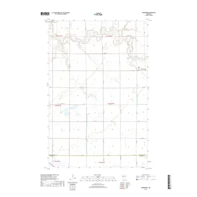
2019 Map of Terrebonne
USGS Topo · Published 2019About this map
The Clearwater River meanders across this northern Minnesota landscape, where the settlement of Terrebonne serves as a local focal point. This 2019 survey documents a highly organized agricultural region defined by an extensive network of water management, including the County Ditch Number Sixtyfour and Judicial Ditch Number Sixtyseven. These engineered waterways, alongside Beau Gerlot Cr and Lower Badger Cr, illustrate the long-standing efforts to drain the fertile plains of the Red River Valley for cultivation.
Find a feature on this map
30 named features on this map. Tap any name to fly to it.
Don’t see what you’re looking for? This feature index may not catch every label — zoom into the map to look around manually.
Map Details
Editions of this 2019 Terrebonne Map
This is the sole edition of this map. No revisions or reprints were ever made.
Other maps of this area

1918 · Terrebonne
USGS Topo · 1:62,500

1918 · Red Lake Falls
USGS Topo · 1:62,500

1919 · Valley
USGS Topo · 1:62,500

1952 · Red Lake Falls
USGS Topo · 1:62,500

1952 · Grand Forks
USGS Topo · 1:250,000

1956 · Grand Forks
USGS Topo · 1:250,000
1964 · Plummer NW
USGS Topo · 1:24,000

1964 · Terrebonne
USGS Topo · 1:24,000
1964 · Plummer
USGS Topo · 1:24,000

1964 · Brooks
USGS Topo · 1:24,000