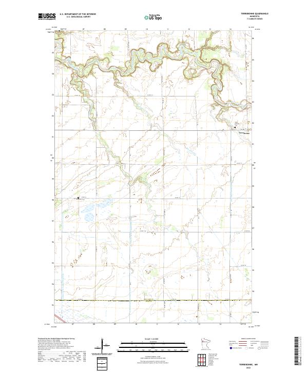
2022 Map of Terrebonne
USGS Topo · Published 2022About this map
The Clearwater River meanders through the northern reaches of this northwestern Minnesota landscape, where the small settlement of Terrebonne sits at a critical junction of local roads and waterways. This area is defined by a complex hydraulic network of natural creeks and engineered drainage systems, including Beau Gerlot Cr and Judicial Ditch Number Sixty-four, reflecting the region's agricultural history and the necessity of managing the Red River Valley's low-lying terrain. The map captures the boundary line between Red Lake Co and Polk Co along its southern edge.
Find a feature on this map
29 named features on this map. Tap any name to fly to it.
Don’t see what you’re looking for? This feature index may not catch every label — zoom into the map to look around manually.
Map Details
Editions of this 2022 Terrebonne Map
This is the sole edition of this map. No revisions or reprints were ever made.
Other maps of this area

1918 · Terrebonne
USGS Topo · 1:62,500

1918 · Red Lake Falls
USGS Topo · 1:62,500

1919 · Valley
USGS Topo · 1:62,500

1952 · Red Lake Falls
USGS Topo · 1:62,500

1952 · Grand Forks
USGS Topo · 1:250,000

1956 · Grand Forks
USGS Topo · 1:250,000
1964 · Plummer NW
USGS Topo · 1:24,000

1964 · Terrebonne
USGS Topo · 1:24,000
1964 · Plummer
USGS Topo · 1:24,000

1964 · Brooks
USGS Topo · 1:24,000