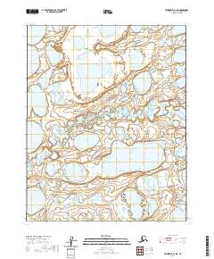
2020 Map of Teshekpuk A-1 NE
USGS Topo · Published 2020About this map
Pik Dunes and the meandering path of Inicok Creek dominate this landscape within the North Slope Borough, captured in 2020 by the U.S. Geological Survey. The terrain is defined by a dense network of unnamed lakes and thermokarst features typical of the Arctic coastal plain, where water and permafrost dictate the geography. The absence of roads or permanent structures underscores the remote character of this region, which remains largely shaped by natural hydrological processes and wind-driven sediment movement.
Find a feature on this map
8 named features on this map. Tap any name to fly to it.
Don’t see what you’re looking for? This feature index may not catch every label — zoom into the map to look around manually.
Map Details
Editions of this 2020 Teshekpuk A-1 NE Map
This is the sole edition of this map. No revisions or reprints were ever made.
Other maps of this area

1951 · Harrison Bay
USGS Topo · 1:250,000

1951 · Teshekpuk
USGS Topo · 1:250,000

1955 · Harrison Bay
USGS Topo · 1:250,000

1955 · Teshekpuk
USGS Topo · 1:250,000

1955 · Teshekpuk A-1
USGS Topo · 1:63,360

1955 · Teshekpuk B-1
USGS Topo · 1:63,360

1955 · Harrison Bay B-5
USGS Topo · 1:63,360

1955 · Harrison Bay A-5
USGS Topo · 1:63,360

1964 · Teshekpuk
USGS Topo · 1:250,000
2013 · Harrison Bay B-5 SW
USGS Topo · 1:25,000