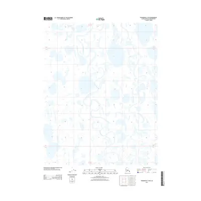
2013 Map of Teshekpuk C-5 SW
USGS Topo · Published 2013About this map
Topagoruk River meanders across this northern landscape in the early twenty-first century, forming complex oxbows and secondary channels that define the hydrology of the North Slope. The terrain is characterized by an intricate network of thaw lakes and ponded water, reflecting the unique permafrost-influenced drainage patterns of the region. This 2013 survey documents the land as it appeared within the T 15 N T 14 N and T 14 N T 13 N townships, where the absence of roads or permanent structures emphasizes the environmental continuity of this Arctic tundra zone. The detailed topography illustrates how the river system continuously reshapes the surrounding basin through seasonal cycles.
Find a feature on this map
4 named features on this map. Tap any name to fly to it.
Don’t see what you’re looking for? This feature index may not catch every label — zoom into the map to look around manually.
Map Details
Editions of this 2013 Teshekpuk C-5 SW Map
This is the sole edition of this map. No revisions or reprints were ever made.
Other maps of this area

1951 · Meade River
USGS Topo · 1:250,000

1951 · Teshekpuk
USGS Topo · 1:250,000

1955 · Teshekpuk
USGS Topo · 1:250,000

1955 · Teshekpuk C-5
USGS Topo · 1:63,360
1955 · Teshekpuk B-5
USGS Topo · 1:63,360

1955 · Meade River
USGS Topo · 1:250,000

1955 · Meade River B-1
USGS Topo · 1:63,360

1955 · Meade River C-1
USGS Topo · 1:63,360

1964 · Teshekpuk
USGS Topo · 1:250,000
2013 · Teshekpuk B-5 NW
USGS Topo · 1:25,000