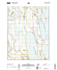
2020 Map of Teshekpuk D-1 SE
USGS Topo · Published 2020About this map
The Smith River meanders through this Arctic coastal plain landscape, characterized by an intricate network of lakes and wetlands typical of the North Slope. This 2020 USGS survey of the Teshekpuk D-1 SE area documents the hydrography of the region during the early 21st century. The map represents a highly saturated environment where the distinctions between river channels and standing water are fluid, reflecting the seasonal hydrology of the Alaskan tundra. While no permanent settlements or structures are indicated, the data provides a baseline for the geographical shifts of the Smith River and its surrounding water bodies. This material is particularly valuable for researchers tracking environmental changes or hydrographic shifts within the North American Datum of 1983 framework.
Find a feature on this map
8 named features on this map. Tap any name to fly to it.
Don’t see what you’re looking for? This feature index may not catch every label — zoom into the map to look around manually.
Map Details
Editions of this 2020 Teshekpuk D-1 SE Map
This is the sole edition of this map. No revisions or reprints were ever made.
Other maps of this area

1951 · Harrison Bay
USGS Topo · 1:250,000

1951 · Teshekpuk
USGS Topo · 1:250,000

1955 · Harrison Bay
USGS Topo · 1:250,000

1955 · Teshekpuk
USGS Topo · 1:250,000

1955 · Harrison Bay C-5
USGS Topo · 1:63,360

1955 · Harrison Bay D-5
USGS Topo · 1:63,360

1955 · Teshekpuk D-1
USGS Topo · 1:63,360
1955 · Teshekpuk C-1
USGS Topo · 1:63,360

1962 · Harrison Bay C-5
USGS Topo · 1:50,000
1962 · Harrison Bay D-5
USGS Topo · 1:50,000