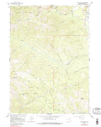
1963 Map of Teton Pass
USGS Topo · Published 1991About this map
Teton Pass serves as the focal point for this 1960s survey of the high-elevation divide between the Targhee National Forest and Teton National Forest. The map documents a landscape defined by dramatic relief and alpine drainage systems, where the headwaters of the Teton River and numerous creeks like Mosquito Creek and Fall Creek carve through the Teton Range. Human presence is concentrated near the eastern edge at Wilson, while the interior is marked by specialized infrastructure including the Lee Guard Station and a Radio Tower perched on the heights.
Find a feature on this map
42 named features on this map. Tap any name to fly to it.
Don’t see what you’re looking for? This feature index may not catch every label — zoom into the map to look around manually.
Map Details
Editions of this 1963 Teton Pass Map
3 editions found

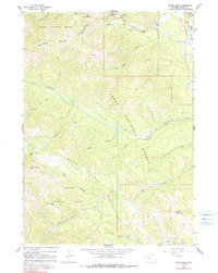
Other maps of this area

1899 · Grand Teton
USGS Topo · 1:125,000

1901 · Grand Teton
USGS Topo · 1:125,000

1931 · Jackson
USGS Topo · 1:125,000

1932 · Irwin
USGS Topo · 1:96,000

1935 · Irwin
USGS Topo · 1:125,000

1935 · Jackson
USGS Topo · 1:125,000

1943 · Driggs
USGS Topo · 1:62,500

1946 · Driggs
USGS Topo · 1:62,500

1955 · Driggs
USGS Topo · 1:250,000

1958 · Driggs
USGS Topo · 1:250,000