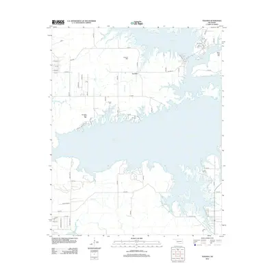
2012 Map of Texanna
USGS Topo · Published 2012About this map
Texanna serves as the focal point of this landscape where the waters of Eufaula Lake meet a series of prominent peaks and ridgelines. The irregular shoreline of the reservoir dominates the topography, reaching into the foothills of Texanna Mtn and Standing Rock Mtn. To the east, Black Haw Mtn overlooks the lake’s northeastern reaches near a cluster of residential roads like Black Bass Ave.
Find a feature on this map
62 named features on this map. Tap any name to fly to it.
Don’t see what you’re looking for? This feature index may not catch every label — zoom into the map to look around manually.
Map Details
Editions of this 2012 Texanna Map
This is the sole edition of this map. No revisions or reprints were ever made.
Other maps of this area

1900 · Sansbois
USGS Topo · 1:125,000

1900 · Canadian
USGS Topo · 1:125,000

1909 · Sans Bois
USGS Topo · 1:125,000

1911 · Sansbois
USGS Topo · 1:125,000

1946 · Fort Smith
USGS Topo · 1:250,000

1963 · Porum
USGS Topo · 1:24,000

1963 · Warner NW
USGS Topo · 1:24,000

1963 · Eufaula
USGS Topo · 1:24,000

1963 · Checotah
USGS Topo · 1:24,000

1963 · Texanna
USGS Topo · 1:24,000