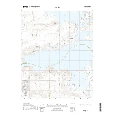
2018 Map of Texanna
USGS Topo · Published 2018About this map
Eufaula Lake dominates this landscape where the boundaries of McIntosh, Haskell, and Pittsburg counties converge. The rugged topography is defined by prominent elevations like Texanna Mtn and Standing Rock Mtn, which rise sharply from the water's edge. The area is intersected by a network of rural roads such as Texanna Rd and N4220 Rd, providing access to lakeside developments and the interior highlands. Local history is anchored by the presence of Triplett Cem and Looken Cem, which serve as quiet markers of the region's earlier generations. The drainage pattern of Texanna Br, Piney Cr, and Brooken Cr illustrates how the shoreline has evolved into a complex system of inlets and ridges. This modern survey reflects the contemporary balance between recreational water use and the persistent rural character of eastern Oklahoma.
Find a feature on this map
95 named features on this map. Tap any name to fly to it.
Don’t see what you’re looking for? This feature index may not catch every label — zoom into the map to look around manually.
Map Details
Editions of this 2018 Texanna Map
This is the sole edition of this map. No revisions or reprints were ever made.
Other maps of this area

1900 · Sansbois
USGS Topo · 1:125,000

1900 · Canadian
USGS Topo · 1:125,000

1909 · Sans Bois
USGS Topo · 1:125,000

1911 · Sansbois
USGS Topo · 1:125,000

1946 · Fort Smith
USGS Topo · 1:250,000

1963 · Porum
USGS Topo · 1:24,000

1963 · Warner NW
USGS Topo · 1:24,000

1963 · Eufaula
USGS Topo · 1:24,000

1963 · Checotah
USGS Topo · 1:24,000

1963 · Texanna
USGS Topo · 1:24,000