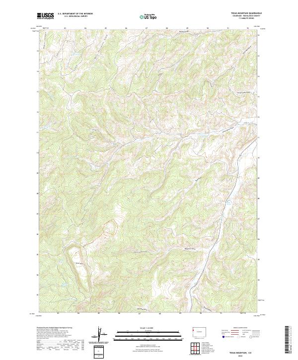
2022 Map of Texas Mountain
USGS Topo · Published 2022About this map
Texas Mountain anchors this high-elevation landscape in the Piceance Basin, revealing a complex network of ephemeral drainages and essential water sources within Rio Blanco County. The 2022 survey details the vital role of natural springs, such as Wild Rose Spring, Big Cedar Spring, and Sand Spring, which provide life in a region defined by its deep draws and canyons. Small-scale water management is evident at Water Canyon Reservoir and Little Horse Reservoir, serving the needs of this arid rangeland. The terrain is carved by numerous seasonal watercourses, including Waggoner Draw, West Fourmile Draw, and the W Douglas Creek drainage. Transportation is limited to rugged routes like Co RD 116 and Co RD 107, highlighting the area's isolation and its primary use for livestock grazing or resource management under the modern Public Land Survey System.
Find a feature on this map
26 named features on this map. Tap any name to fly to it.
Don’t see what you’re looking for? This feature index may not catch every label — zoom into the map to look around manually.
Map Details
Editions of this 2022 Texas Mountain Map
This is the sole edition of this map. No revisions or reprints were ever made.
Other maps of this area

1956 · Grand Junction
USGS Topo · 1:250,000

1959 · Grand Junction
USGS Topo · 1:250,000

1960 · Grand Junction
USGS Topo · 1:250,000

1962 · Grand Junction
USGS Topo · 1:250,000

1964 · Grand Junction
USGS Topo · 1:250,000

1964 · Texas Creek
USGS Topo · 1:24,000

1964 · Brushy Point
USGS Topo · 1:24,000
1964 · Philadelphia Creek
USGS Topo · 1:24,000

1964 · East Evacuation Creek
USGS Topo · 1:24,000
1964 · Water Canyon
USGS Topo · 1:24,000