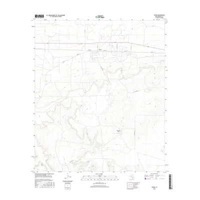
2016 Map of Texon
USGS Topo · Published 2016About this map
Texon stands as the primary hub of human activity in this 2016 study of Reagan County, situated along the corridor of Highway 67. The surrounding landscape is defined by the stark drainage patterns of the Permian Basin, where the intermittent flow of Live Oak Cr and Big Lake Draw shapes the terrain. Man-made infrastructure is vital to this arid region, evidenced by the presence of Pipeline Tank and Alta Loma Tank, which support local livestock and industry.
Find a feature on this map
17 named features on this map. Tap any name to fly to it.
Don’t see what you’re looking for? This feature index may not catch every label — zoom into the map to look around manually.
Map Details
Editions of this 2016 Texon Map
This is the sole edition of this map. No revisions or reprints were ever made.
Other maps of this area

1928 · Rankin
USGS Topo · 1:125,000

1954 · San Angelo
USGS Topo · 1:250,000

1958 · San Angelo
USGS Topo · 1:250,000

1965 · San Angelo
USGS Topo · 1:250,000

1970 · Sevenmile Corner SE
USGS Topo · 1:24,000
1970 · Rankin SE
USGS Topo · 1:24,000
1970 · Texon SE
USGS Topo · 1:24,000
1970 · Rankin NE
USGS Topo · 1:24,000

1970 · Garrison Draw
USGS Topo · 1:24,000

1970 · Gardener Draw
USGS Topo · 1:24,000