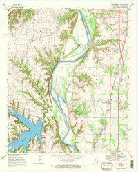
1968 Map of Thackerville
USGS Topo · Published 1971About this map
The Red River creates a meandering border between Oklahoma and Texas, defining the geography of this late 1960s survey. On the Oklahoma side, the community of Thackerville sits near the Atchison Topeka and Santa Fe railroad line, featuring local landmarks such as the Rodeo Ground and a Pumping Station. To the west, across the river's bend into Texas, Sivells Bend is marked by its namesake school Sivells Bend Sch and a local refinery serving the Sivells Bend Field.
Find a feature on this map
40 named features on this map. Tap any name to fly to it.
Don’t see what you’re looking for? This feature index may not catch every label — zoom into the map to look around manually.
Map Details
Editions of this 1968 Thackerville Map
2 editions found
Other maps of this area

1902 · Gainesville
USGS Topo · 1:125,000

1943 · Gainesville
USGS Topo · 1:125,000

1954 · Sherman
USGS Topo · 1:250,000

1958 · Sherman
USGS Topo · 1:250,000

1960 · Callisburg
USGS Topo · 1:24,000

1960 · Gainesville North
USGS Topo · 1:24,000

1961 · Muenster East
USGS Topo · 1:24,000
1967 · Marietta East
USGS Topo · 1:24,000
1968 · Thackerville
USGS Topo · 1:24,000
1968 · Burneyville
USGS Topo · 1:24,000