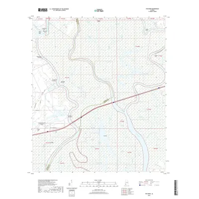
2018 Map of The Basin
USGS Topo · Published 2018About this map
The sprawling delta environment where the Mobile River and Tensaw River diverge defines this landscape northeast of Creola. The area is a complex network of wetlands and waterways, featuring named points such as Gainesville Point and White Horse Point alongside the historical landmarks of Twentyfour Mile Bluff and Twentyone Mile Bluff. This 2018 survey reveals the intricate hydrography of the region, where the Middle River snakes between Mound Island and The Basin, a testament to the shifting alluvial geography of Mobile and Baldwin counties.
Find a feature on this map
58 named features on this map. Tap any name to fly to it.
Don’t see what you’re looking for? This feature index may not catch every label — zoom into the map to look around manually.
Map Details
Editions of this 2018 The Basin Map
This is the sole edition of this map. No revisions or reprints were ever made.
Other maps of this area

1941 · Chickasaw
USGS Topo · 1:31,680

1941 · Bay Minette
USGS Topo · 1:62,500

1941 · Creola
USGS Topo · 1:62,500

1942 · Hurricane
USGS Topo · 1:31,680
1943 · Hurricane
USGS Topo · 1:31,680

1943 · Creola
USGS Topo · 1:62,500

1943 · Chickasaw
USGS Topo · 1:31,680

1943 · Bay Minette
USGS Topo · 1:62,500

1943 · Tensaw
USGS Topo · 1:62,500

1943 · Citronelle
USGS Topo · 1:62,500