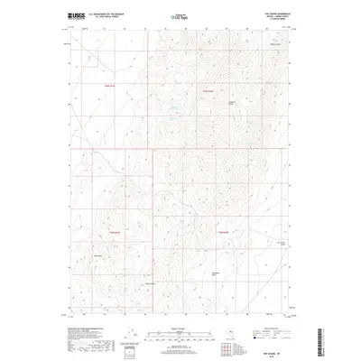
2018 Map of The Cedars
USGS Topo · Published 2018About this map
The Cedars marks a high-elevation point in the high desert of Lander County, overlooking a landscape defined by the sharp verticality of the Shoshone Range. This modern survey reveals a reliance on essential water sources in an arid environment, noting specific points such as Watt Spring Number Three, Watt Creek Spring, and Blue Rock Spring. These perennial or intermittent water features likely dictated the movement of livestock and people through the complex terrain of Wood Canyon and into the Horseshoe Basin. To the east, the topography transitions into the broader expanse of the Carico Lake Valley, while the northern peaks are anchored by the distinctive Elephant Head. The lack of dense road networks or settlements emphasizes the remote, resource-driven character of this part of the Nevada interior, where the land is managed largely through grazing and ranching infrastructure.
Find a feature on this map
14 named features on this map. Tap any name to fly to it.
Don’t see what you’re looking for? This feature index may not catch every label — zoom into the map to look around manually.
Map Details
Editions of this 2018 The Cedars Map
This is the sole edition of this map. No revisions or reprints were ever made.
Other maps of this area

1926 · Roberts Mountains
USGS Topo · 1:250,000

1929 · Roberts Mountains
USGS Topo · 1:250,000

1932 · Sonoma Range
USGS Topo · 1:250,000

1939 · Sonoma Range
USGS Topo · 1:250,000

1955 · Millett
USGS Topo · 1:250,000

1955 · Winnemucca
USGS Topo · 1:250,000

1956 · Hall Creek
USGS Topo · 1:62,500

1958 · Winnemucca
USGS Topo · 1:250,000

1959 · Millett
USGS Topo · 1:250,000

1961 · The Cedars
USGS Topo · 1:62,500