Loading...
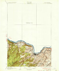
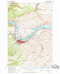
Loading map...1934 Map of The Dalles
USGS Topo · Published 1934About this map
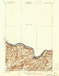
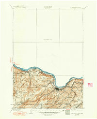
The Dalles serves as the focal point for this mid-1930s survey, situated where the Columbia River transitions through its famous gorge. The riverfront is a busy artery of movement, defined by the Union Pacific railroad and a Toll Bridge connecting Oregon and Washington. This era reveals a landscape of dispersed agricultural communities and rural education, marked by numerous district schoolhouses such as Chenoweth Sch, Lone Pine Sch, and Fairbanks Sch.
Find a feature on this map
41 named features on this map. Tap any name to fly to it.
Don’t see what you’re looking for? This feature index may not catch every label — zoom into the map to look around manually.
Map Details
Date Portrayed1934
Date Published1934
PublisherU.S. Geological Survey
Map TypeTopographic
Scale1:125,000
Physical Dimensions16.6 x 19.8 inches
Editions of this 1934 The Dalles Map
4 editions found

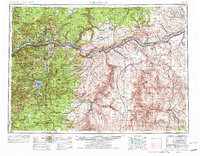
Historical Maps of The Dalles Through Time
5 maps found


Featured Locations
Source Details
SourceU.S. Geological Survey
CopyrightPublic Domain