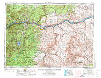
1953 Map of The Dalles
USGS Topo · Published 1974About this map
Mount Hood dominates the western landscape of this mid-century survey, its ice-capped peak anchoring the Mount Hood National Forest while the Columbia River carves a deep path through the eastern plateau. The map captures a pivotal era for the river corridor, showing The Dalles Dam St Pk and Lake Cellilo during the early years of the dam's operation. This industrial and transport artery is lined with critical infrastructure, from the Union Pacific and Spokane Portland and Seattle railroads to the Marshall Museum and several state parks like Mayer St Pk and Celilo St Pk. To the south and east, the transition from timbered heights to dry wheat country is marked by settlements such as Tygh Valley, Maupin, and Grass Valley. Significant indigenous lands are noted at the Warm Springs Indian Reservation and Yakima Indian Reservation, reflecting the complex heritage of the mid-Columbia region.
Find a feature on this map
77 named features on this map. Tap any name to fly to it.
Don’t see what you’re looking for? This feature index may not catch every label — zoom into the map to look around manually.
Map Details
Editions of this 1953 The Dalles Map
3 editions found

Other maps of this area

1904 · Mount Adams
USGS Topo · 1:125,000

1906 · Blalock Island
USGS Topo · 1:125,000

1907 · Mount Adams
USGS Topo · 1:125,000

1908 · Blalock Island
USGS Topo · 1:125,000

1910 · Zillah
USGS Topo · 1:125,000

1915 · Prosser
USGS Topo · 1:125,000

1916 · Arlington
USGS Topo · 1:125,000

1916 · Estacada
USGS Topo · 1:125,000

1916 · Condon
USGS Topo · 1:125,000

1917 · Prosser
USGS Topo · 1:125,000