1957 Map of The Dalles
USGS Topo · Published 1969About this map
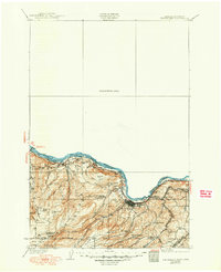
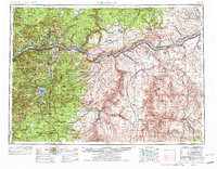
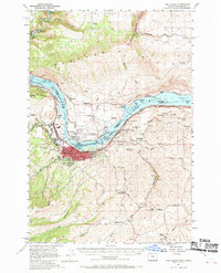
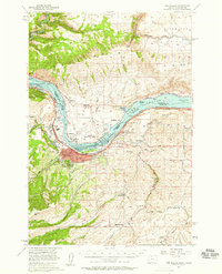
The industrial and transport hub of The Dalles (Dalles City) dominates this mid-century survey, showcasing a landscape transformed by the newly constructed The Dalles Dam. This massive engineering project on the Columbia River created Lake Celilo, a slack-water reservoir that altered the river's character and the surrounding terrain. On the Oregon side, the city's infrastructure includes the E Oregon Hospital and an extensive network of streets protected by a Levee. Across the water in Washington, the settlements of Dallesport, Murdock, and Spearfish flank The Dalles Municipal Airport. The map also captures the vital transit corridors of the era, with the Union Pacific Railroad hugging the southern shore and the Spokane Portland and Seattle Railway running along the northern bank through the Columbia Hills.
Find a feature on this map
72 named features on this map. Tap any name to fly to it.
Don’t see what you’re looking for? This feature index may not catch every label — zoom into the map to look around manually.
Map Details
Editions of this 1957 The Dalles Map
3 editions found

Historical Maps of The Dalles Through Time
5 maps found