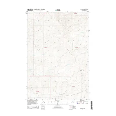
2014 Map of The Dugout
USGS Topo · Published 2014About this map
The Dugout marks a point of activity in the southern reach of this landscape, situated along MT-384 in a region defined by complex drainage networks and high terrain. The area is characterized by an intricate system of seasonal and perennial waterways, including Ninemile Cr and its tributary Little Ninemile Cr, which flow through the western sections. To the east, the terrain rises toward Haystack Butte, a prominent landmark that overlooks the headwaters of Lazy Man Cr and Big Meadow Cr.
Find a feature on this map
17 named features on this map. Tap any name to fly to it.
Don’t see what you’re looking for? This feature index may not catch every label — zoom into the map to look around manually.
Map Details
Editions of this 2014 The Dugout Map
This is the sole edition of this map. No revisions or reprints were ever made.
Other maps of this area

1894 · Fort Custer
USGS Topo · 1:125,000

1954 · Hardin
USGS Topo · 1:250,000

1957 · Hardin
USGS Topo · 1:250,000

1958 · Hardin
USGS Topo · 1:250,000

1960 · Foster
USGS Topo · 1:24,000

1960 · Ninemile Point
USGS Topo · 1:24,000

1960 · Hardin
USGS Topo · 1:24,000

1967 · Crow Agency NE
USGS Topo · 1:24,000
1967 · Little Dry Creek
USGS Topo · 1:24,000
1972 · The Dugout
USGS Topo · 1:24,000